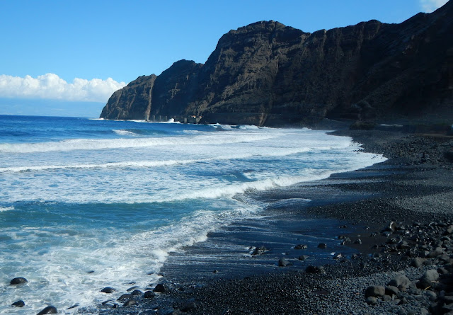
La Gomera has been called the "land that time forgot" and having spent 4 glorious hiking days here, we can certainly understand why.
This UNESCO Biosphere is unique to the world. On this second smallest island of the 7 Canary Islands, La Gomera is only 14 miles in diameter with the area of 142 square miles. Its highest point is 4,879 feet.
But in spite of its size, La Gomera packs a unique environment all within a short distance from each other as the "crow flies" in terms of distance, but getting from one side of this rugged volcanic island to the other is another thing entirely.
Below is the lush green gorge of Valle Gran Rey

But in spite of its size, La Gomera packs a unique environment all within a short distance from each other as the "crow flies" in terms of distance, but getting from one side of this rugged volcanic island to the other is another thing entirely.
Below is the lush green gorge of Valle Gran Rey

This volcanic island is ringed with rugged cliff faces and carpeted in ancient forests and palm tree flecked valleys. La Gomera has almost a Jurassic Park feel to it.
the banana plantations of the lower region


with their incredible stone walled terracing that has been there for generations,

Thanks to the trade winds, the highlands are perpetually shrouded in mist, lending the island a mysterious quality.
La Gomera's Cloud Forest
Garajonay National Park


with their incredible stone walled terracing that has been there for generations,

Thanks to the trade winds, the highlands are perpetually shrouded in mist, lending the island a mysterious quality.
On our way to the Cloud Forest we saw the "volcanic plug" of Roque de Anagdo
La Gomera's Cloud Forest
Garajonay National Park
the last remaining cloud forest in Europe

Our first hike was in the Cloud forest where the the mountains catch the passing trade winds forming a lush subtropical environment. As we were hiking thru the foggy cloud forest, it started to rain which created a magical, mystical air.
The moss laddened laural and heather trees, (yes, heather trees), thrive in this ecosystem. A cloud forest is also called a water forest for water from the clouds and fog is collected in the moss ladened trees causing the "fog drip" phenomenon... layers of moss slowly dripping water onto the forest floor, thus nourishing and protecting the large laural and massive heather trees.
Everywhere we hiked we saw the centuries' old stone terracing, built by back-breaking labor. Only masterful stone fitting and stone wedging have they withstood the test of time. No cement was used. It was astounding!
Part of one hiking day took us on these stone terraces below
Some of the trails were a bit narrow
and often the trails were quite steep
with the ocean roaring down below.

Every day we had beautiful blue skies and stunning views of El Teide over on Tenerife.

Each day's hike had steep ridges to hike up and traverse and then hike down again.

Our next day's hike was 9.5 miles, 19,372 steps and 39 floors on Jeff's iphone; but the phone wasn't on for the full hike! So there were many more uncounted steps and floors.
This hike had a steep ascent to El Palmar and the descent into Hermigua. From there we walked back to Agulo across a steep ravine.
Just when we thought we were up as high as one could go, we saw a paraglider come sailing by.
Our hikes in the rugged volcanic mountains were all impressive.
The next day's hike was from Juego de bolas to Villahermoso.
We hiked through laural and heather forested areas which encircled us. Can you find Jeff?
All too soon, we had a steep ascent and then later there was a very slippery, very steep descent on the top part of the trail.


It was a long, hot hike, but we finally saw the town far below and we were rewarded with a breathtakingly beautiful bird's eye view of Villahermoso.
It was a long way down to
Villahermoso


Afterwards, as we hiked into town, there in the middle of the "town center" round-a-bout were the large letters welcoming us: "Buenvendos a Vallehermoso!"

More photos of our next 3 days of hiking La Gomera will be posted soon.


